Stay up to date with the latest news

Landmark Project: Áras an Uachtaráin
I’m delighted to let you know that our family-run, father-and-daughter team was recently entrusted with a topographic survey in the gardens of Áras an Uachtaráin, the official residence of the President of Ireland in Phoenix Park, Dublin.
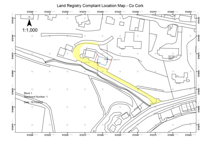
Land Registry Compliant Multi Story, Subdivision and Rectification Mapping – Case Study
Case Study: To Prepare Accurate Land Registry Compliant Maps to enable the separate sale of 4 No Apartments, 2 No cottages, the remainder of the site would be transferred to my client’s son with the exception of a site for my client.
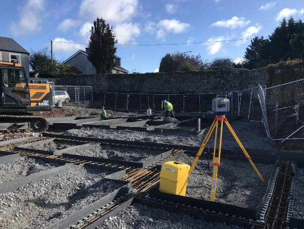
Sub Millimetre Setting Out & Surveying by Baseline Surveys Ltd
There are a number of critical components to being able to produce extremely accurate setting out or surveying. The most important component is being fully relaxed and focused, because of this it’s important to reduce the amount of environmental distractions as much as possible and to fully ignore everything except what you are doing.
How Engineers can Avoid Embarrassing Land Registry Malfunctions
I will be examining the problematic and very common practice of transferring land by submitting paper maps to Land Registry and how it can go terribly wrong when a planning permission application is made on the same plot of land and what you can do to avoid disaster. The solution is surprisingly simple.

Aviation Industry Awards Finalist
Baseline Surveys is a proud finalist of the Aviation Awards Industry for the Aviation Innovation Award 2014.
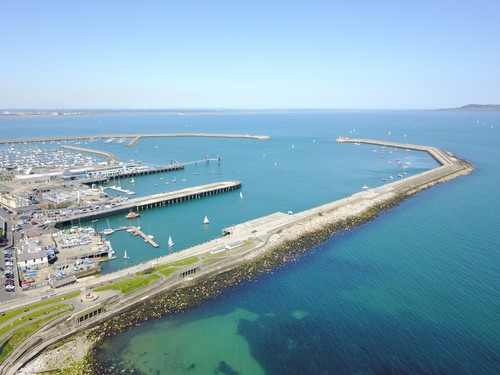
UAS Applied
Baseline provides a topographical survey of a harbour in Ireland with a UAS - avoiding significant disruption and risk that would have been created by a conventional survey.
CONTACT BASELINE SURVEYS TODAY FOR A FREE CONSULTATION
We are available now and we have a very fast turnaround time.
Paudie would be delighted to discuss your legal mapping services
Or email: paudie@baselinesurveys.ie
